Facebook
 Google
 GitHub
 Linkedin
Smart Drone Doubles Down on Transmission Line Threats
Korean researchers have developed an enhanced unmanned aerial vehicle system to simultaneously monitor sagging transmission lines and vegetation encroachment.
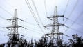
Transmission lines are huge power networks that cross a range of landscapes, from forests to mountains, agricultural regions, and many more in between. Vegetation and other environmental factors can damage the lines. Sagging lines can worsen the problem.
Monitoring lines can be difficult if the lines are remote or if trees, hillsides, and other terrain interfere with reliable measurements. However, Hangyang University researchers have taken to the skies and developed unmanned aerial vehicles (UAVs or drones) equipped with LiDAR, GPS, and inertial measurement unit (IMU) sensors to assess environmental infringement and sag across various landscapes simultaneously.

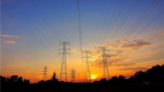
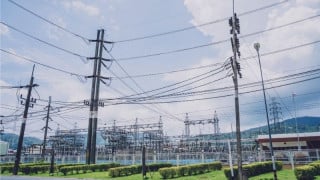
Sagging transmission lines in a dense forest. Image used courtesy of Adobe Stock
Sagging Transmission Lines and Environmental Risks
Transmission line sagging can affect the ground clearance and safety of power facilities. These lines can hit trees and other obstacles that might cause faults, electrical arcing, fire hazards, structural damage, or even snapping of the power lines.
Many environmental factors, including temperature, wind, and mechanical stress, can affect how a transmission line sags. Estimating the level of sag in a power line is crucial for ensuring that it is not likely to cause damage, but this is harder to do from land in obstructed environments.
Environmental infringement is a more prominent issue when transmission lines pass through agricultural land or forested areas. In these scenarios, the proximity of trees, vegetation, and other natural structures can lead to localized short circuits, installation failure, and wildfires.
Challenges of Diverse Landscapes on Transmission Line Monitoring
Monitoring transmission lines using ground-based visual inspections is difficult in some terrains, and it’s even more challenging to provide a continued evaluation of transmission line sites in forested and mountainous areas. Manual ground-based inspections require intense personnel use, making it difficult to inspect long stretches of transmission line networks.
Helicopter-based surveys can provide quicker insights over wide coverage areas, but the distance from the helicopter to the transmission line means that small defects and localized structural issues are hard to detect. Helicopter inspections are also expensive and rely heavily on favorable weather to perform observations.
Multimodal UAV Sensing Approach Offers Better Monitoring Capabilities
Researchers at Hangyang University used UAVs to capture multimodal information from 3D LiDAR, GPS, and IMUs. They converted the data output into a geometric profile of the transmission lines, which could then be used to estimate the transmission line sag using the line temperature and its thermo-mechanical behavior. The method could also investigate the level of environmental infringement by comparing the line’s sag profile with the spatial distribution of the surrounding natural objects.
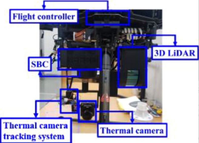
The multimodal UAV. Image used courtesy of Jeong et al.
The approach provided real-time measurements and predictive capabilities to examine scenarios where the thermal loading would be enough to cause environmental infringement.
In the detection process, the sensor array allows acquisition of multimodal data on the vegetation and natural obstacles. Quantifying the effects of abnormal thermal loads on transmission line tension can give the extreme operational temperature. The researchers used algorithms to ensure that no uncertainties appeared in the sensor data or repeatability measurements.
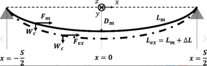
Measuring the sag and line tension. Image used courtesy of Jeong et al.
Once the process has established the sag profile, it generates an infringement zone. The infringement zone contains a required clearance and uncertainty margin, and environmental point cloud data determines any infringement into this zone from obstacles.
UAV Method Advantages
The UAV-based process can operate under various environmental conditions, including in areas with vegetation growth, uneven terrain, and in locations where nearby structures are at risk of coming into contact with transmission infrastructure. It can monitor and predict a range of potential issues on transmission infrastructure, including:
- Intrusion depth and vegetation density at different points along the transmission line
- How the transmission lines will deform under higher temperatures
- How transmission lines will behave during heat waves, abnormal climate events, and under unexpected heavy loads
- Transmission line critical temperature, at which the line tension will exceed the maximum allowable limit based on the sag-tension-temperature relationship
This approach allows for more accurate and robust measurements—including small defects—over long transmission line distances and could function as a monitoring tool that guides maintenance scheduling.
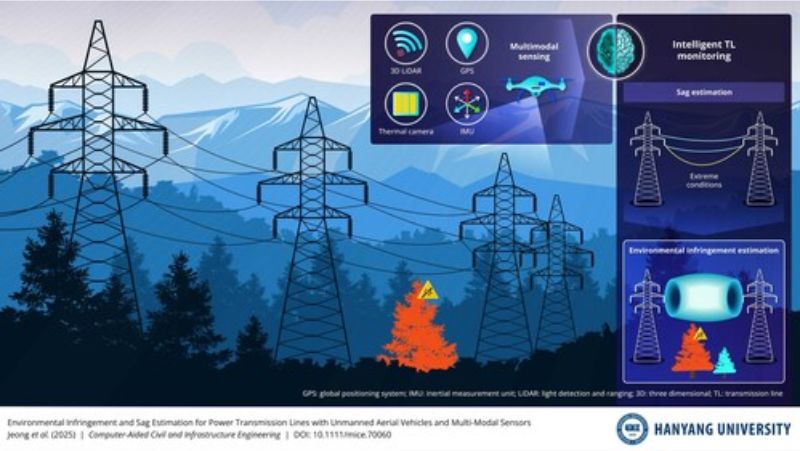
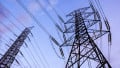
The multimodal UAV system for sag estimation and environmental infringement. Image used courtesy of Hanyang University
Automated monitoring could also help to provide advanced warning of potential issues before they become serious and cause a line failure. This is more difficult with manual methods, but the UAV can probe large distances autonomously with high accuracy. This makes monitoring more feasible and could help to improve the resilience of critical transmission line infrastructure.
An adapted UAV approach could also monitor infrastructure other than transmission lines, or anywhere deformation and environmental interaction occur.
Plans for Further Developments
The researchers have stated that future efforts will focus on UAV autonomy. This will involve onboard adaptive systems and learning-based methods for flight optimization, object detection, and predictive analytics.
Further improvements could also enable the UAVs to operate in a wider range of terrains, with more diverse structural configurations and environmental conditions, to improve the robustness of the monitoring process. Other efforts will include the incorporation of dynamic loading conditions and probabilistic methods to ensure that any uncertainties are quantified more accurately.