Facebook
 Google
 GitHub
 Linkedin
High-Res Imaging and Predictive AI: How AiDash Protects the Grid
AI-coupled satellite data helps assess vegetation risks, prevent outages, and restore power faster.
For decades, vegetation management has primarily relied on human inspections, remote sensors, drones, helicopters, geographic information systems (GIS), and LiDAR data. These solutions are often costly and come with technical limitations. Vegetation management is often the highest line item in utilities’ budgets.
Watch a demonstration of AiDash’s Climate Risk Intelligence System. Video used courtesy of AiDash
Advanced satellites, on the other hand, can deliver frequent and up-to-date data covering 10,000 miles of vegetation in one day. Combining high-resolution imaging with predictive AI unlocks a cost-effective tool to supplement manual field estimates.
California-based AiDash is helping the power sector manage vegetation challenges with AI- and satellite-enabled software. The startup’s AI models identify real-time vegetation risks, predict outages days before landfall, and prioritize grid-hardening activities. Its SatelliteVision technology can scan and process 100,000-mile transmission and distribution networks in weeks.
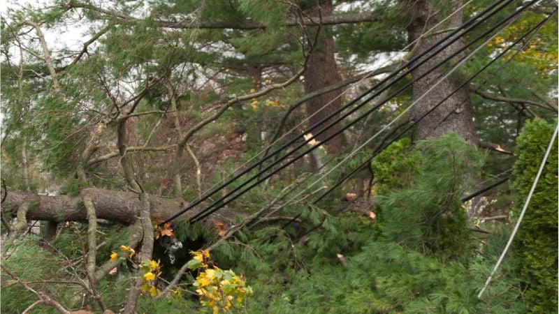
Power lines wrapped in a fallen tree. Image used courtesy of the Federal Emergency Management Agency (Page 9)
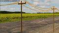
Combating Vegetation Risks
With 642,000 miles of high-voltage transmission lines and over 6 million miles of local distribution, the U.S. power grid has no shortage of opportunities for trees to hit infrastructure. Data compiled by the North American Electric Reliability Corporation (NERC) indicates hurricanes caused the largest number of transmission outages between 2019 and 2023, followed by winter weather, tornadoes, fires, and thunderstorm-related wind.
Climate change is raising storm frequency and intensity across the U.S. Increasingly frequent wildfires are another significant vulnerability for the power grid, with longer seasons and larger acreages burned annually.
Satellite data and AI tools give utilities a 360-degree view of significant risks within their rights of way (ROW) and adjacent spots. The latter point is useful because utilities might not have visibility into non-ROW areas. North American transmission operators reported 18 sustained outages due to vegetation fall-ins from outside their ROW in 2023, according to NERC. Weather-related activities caused more than 80% of those events.
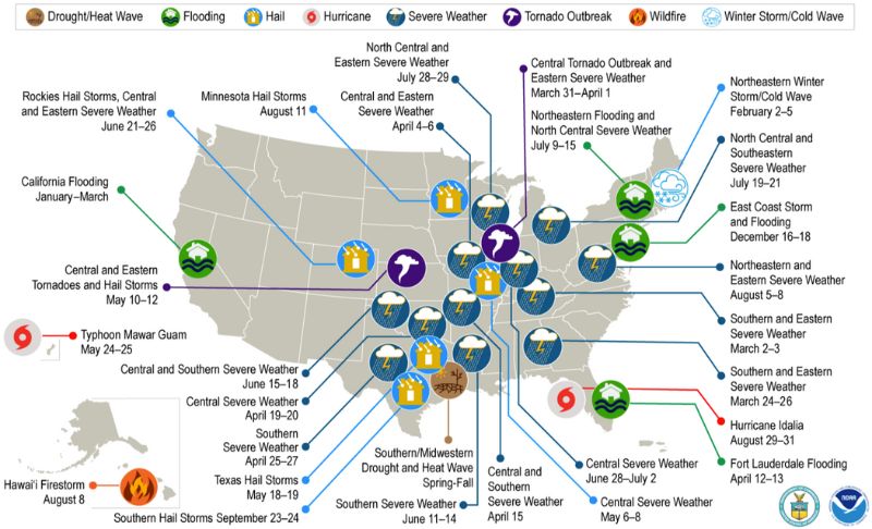
In 2023, these 28 weather and climate disasters incurred billions of dollars in damage across the U.S. Image used courtesy of NERC (Page 5)
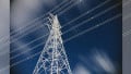
Satellite-Informed AI for Utilities
AiDash combines decades of historical information with today’s GIS data and predictive AI algorithms. The company uses a continuous learning loop method to train its AI models, feeding millions of data points across various geographies, customers, and inputs. A 100,000-mile system can be modeled with historical records about species, growth rates, clearances, and more points. The software automatically creates work plans and risk-based priorities, eliminating time-consuming coordination.
AiDash’s Intelligent Vegetation Management System monitors over 1 million miles of transmission and distribution lines today, and its AI engine has processed over 3 million miles of infrastructure. The software analyzes vegetation abundance and tree height near distribution conductors, among other factors, and calculates natural prune cycles at subcircuit and circuit levels. It also flags signs of sideline and floor growth in transmission ROWs.
_and_mobile_(right)_views_of_AiDash’s_Intelligent_Vegetation_Management_software.jpg)
Desktop (left) and mobile (right) views of AiDash’s Intelligent Vegetation Management software. Image used courtesy of AiDash
The system triggers when 20% of a line is within two feet of the conductor, alerting staff to trim it within one year. In one case study, this feature supplied over 90% accuracy in field validations.
Another AiDash tool, the Climate Risk Intelligent System, integrates satellite imagery, vegetation data, and live weather feeds to predict events within 72 hours before landfall. Post-event features include flood assessments, wildfire damage severity, and the ability to view damage through clouds with synthetic aperture radar data from satellites.
The Climate Risk Intelligence System speeds restoration by 30% and forecasts outages with 85% accuracy. It also presents grid-hardening opportunities based on changing field conditions.
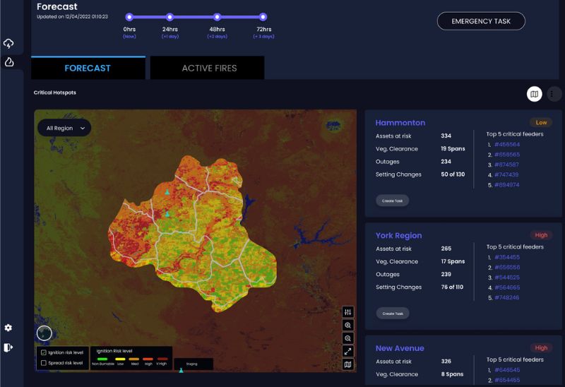
AiDash’s Climate Risk Intelligence System tracks wildfire risks. Image used courtesy of AiDash
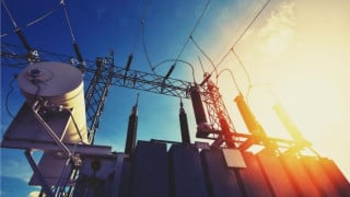
AiDash’s Solution in Practice
AiDash’s solutions have captured more than 150 customers worldwide, including regional utilities like Alabama Power, Xcel Energy, Eversource Energy, and GreyStone Power. The company reports that its customers have cut vegetation expenses by up to 20%.
Some of its investors are major utilities like National Grid in the northeastern U.S., Duke Energy in the Midwest and Southeast, and Edison International in California.
National Grid, which serves New York and Massachusetts, recently told CNBC that AiDash’s software reduced outages by 30% and shortened outage duration by 55%. The company’s case study mentions that National Grid started using its Intelligent Vegetation Management System after several consecutive storms caused one of the worst SAIDI/SAIFI performances in the utility’s history. (The SAIDI and SAIFI indexes measure system average interruption frequency and duration in distribution systems.)
With AI-based vegetation detection, National Grid improved its system-level SAIDI/SAIFI and reduced clearance distances by nearly 85%.
Alabama Power also used the software to map out its 2024 trim plans. The company initially used its own prioritization process, but incorporating data from satellites and AI allowed it to take a condition-based view of unmet needs. As a result, it narrowed its trim area by 200 miles, from 114 segments to just 51.