Facebook
 Google
 GitHub
 Linkedin
Geo-Safe: USGS Map Aids Grid Protection and Resilience
The U.S. Geological Survey has mapped geomagnetic activity in the U.S. to help power engineers better prepare for hazardous electrical storms.
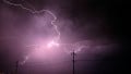
Geomagnetic storms can knock out multiple transformers along transmission lines. While robust materials strengthen the grid, some parts are susceptible to natural weather conditions, especially geomagnetic storms. Geomagnetic storms—from solar winds, most notably solar coronal mass ejection—can cause several issues for the power grid, including damaging multiple transformers simultaneously along the transmission grid.
What are geomagnetic storms? Check out five storms that shaped the Earth. Video used courtesy of the U.S. Geological Survey
To help mitigate the grid’s vulnerability to geomagnetic storms, the U.S. Geological Survey (USGS) office has released the first-ever map of the Earth’s electrical conductivity. The map can allow grid managers to assess hazards and respond to the impacts of geomagnetic activity.

The Aurora Borealis is an example of geomagnetic activity. Image used courtesy of the USGS
Geomagnetic Storms Impacting the Grid
Geomagnetic storms increase the total electron count within the Earth’s atmosphere, interfering with the ionosphere and magnetosphere. This causes magnetospheric and ionospheric currents to manifest from rapidly changing magnetic fields, generating ground-induced currents (GIC).
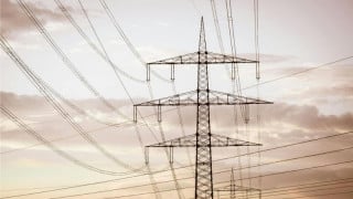
GICs can flow through infrastructure on the ground, including the power grid, underground pipelines, and railway tracks. The GICs appear as near-DC currents, which can saturate and overload transformers, damaging them. The damage and loss of performance can manifest in several ways, including overheating, a drop in system voltage, or an increase in reactive power demand.
The U.S. Magnetotelluric Array (MTArray) collected geomagnetic data through the USGS and its partners for almost two decades. Partners included NASA, the National Science Foundation, the EarthScope Consortium, and Ohio State University (OSU).
Geophysical Study Could Help Protect the US Energy Grid
The MTArray map provides data about how the planet works from an electrical conductivity perspective. This data could be useful for mineral resource and hazard assessments.
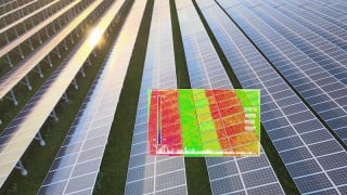
.jpg)
Map of geomagnetic activity. Image used courtesy of USGS
The MTArray investigated how well the rocks in the Earth’s upper mantle and crust conduct electricity. The project used the magnetotelluric array to measure naturally occurring electric and magnetic fields through 27 MT stations, seven permanent stations, and 20 portable stations. The arrays used the natural time variations of the Earth’s magnetic and electric fields to determine the electrical resistivity of Earth’s subsurface.
The MTArray collected real-time geomagnetic field data to build geoelectric field models to determine the current condition of Earth’s electric field. This information allows power system engineers to assess critical grid infrastructure’s vulnerability—especially during magnetoelectric storms—anywhere along the grid, as GICs can occur at all geographical latitudes. Assessing the local real-time information can enable engineers in different regions to adjust their operations during these storms to protect the grid and prevent potential blackouts and other grid disruptions.
The Widespread Geomagnetic Data Collection Network
Over the years, the MTArray has expanded, and today, it collects data from over 1,800 locations across the contiguous states. Aside from looking at how the Earth conducts electricity, the USMTArray has also been used to study the Appalachian Mountains’ geological structure, image fluid cycling below the Western states, ancient suture zones below the Great Plains, and the deep roots of volcanoes—including in Yellowstone—to map the critical mineral potential in the U.S. The USGS stated the data will be analyzed for years to provide advanced hazard assessments for the grid.
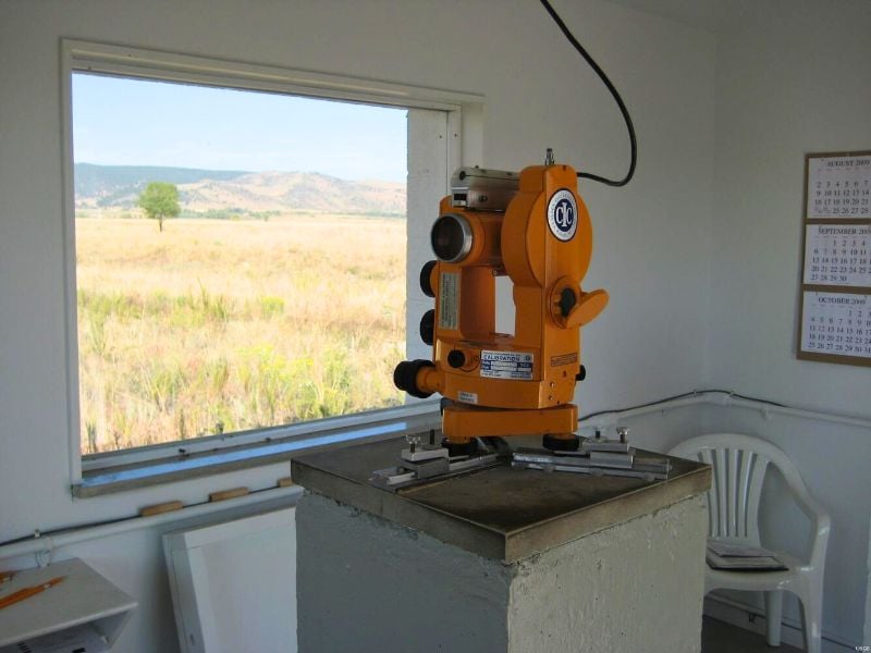
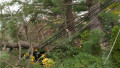
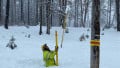
Geomagnetic survey equipment in Boulder, Colorado. Image used courtesy of USGS
USGS Takes Over a Long-Term Project
The USArray conducted the surveys from 2006 to 2018. The MTArray was expanded from 2019 to 2020 across more U.S. states using NASA’s Heliophysics Science Division grant. In 2015, the hazards of geomagnetic storms were reviewed by the 2015 National Space Weather Strategy and National Space Weather Action Plan, leading to a new National Space Weather Strategy and Action Plan in 2019.
Since then, funds have been granted via a Presidential Executive Order, and the USGS budget provides the funds to continue the project. The USGS is working with OSU to finish the project's final phase, which involves continent-scale surveying.