Facebook
 Google
 GitHub
 Linkedin
Sup3rCC Offers Energy Engineers a Look Into the Future
An open-source platform generates high-resolution maps detailing local weather patterns, a critical planning tool in energy systems with heavy wind and solar penetration.
Grid operators, system planners, and energy engineers have traditionally relied on historical meteorological datasets to understand how climate affects wind and solar generation. Thanks to an open-source tool from the National Renewable Energy Laboratory (NREL), they can apply forward-looking simulations to predict weather impacts 40 times faster than conventional data downscaling methods.
The Super-Resolution for Renewable Energy Resource Data with Climate Change Impacts (Sup3rCC) tool models renewable energy and power generation based on decades of weather data. It also simplifies load forecasting and energy resource assessments, which are essential in grid planning and operation.
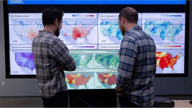
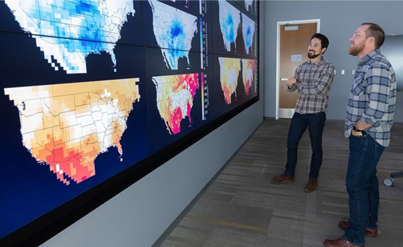
NREL staff review climate data. Image used courtesy of NREL (By Joe DelNero)
Sup3rrCC’s high-resolution maps provide hourly 2.4-mile snapshots of wind speed, temperature, solar irradiance, humidity, and pressure across the contiguous U.S. based on 62-mile daily average data from a global climate model (GCM). GCMs calculate interactions between the atmosphere, land surface, ocean, and sea ice using similar inputs like wind magnitude, temperature, and pressure.
By enhancing this data in “super-resolution” formats, Sup3rCC makes GCMs even more useful for system planning. The tool can be integrated into energy data software, offering output variables to model generation and demand.
Sup3rCC Adds Capabilities Missing from Conventional Models
Sup3rCC produces synthetic spatiotemporal data using generative machine learning. Popularized by the recent wave of advanced chatbots like ChatGPT, generative AI models analyze patterns in their input data and return new data with similar features. Likewise, Sup3rCC learns from the spatial and temporal aspects of meteorological datasets, such as NREL’s solar radiation and wind integration databases, using a generative adversarial network technique.
Generative adversarial networks like the one used to develop Sup3rCC can downscale predicted changes in solar, wind, and temperature fields across several GCMs, including frequent low-wind and high-heat events in the Eastern U.S.
_compared_to_traditional_models_(left).gif)
High-resolution maps generated by Sup3rCC (right) compared to traditional models (left). Image used courtesy of NREL
Sup3rCC overcomes the computational limits of dynamical downscaling, in which GCM outputs are used as inputs for finer-scaled regional models based on local features. Downscaling reveals more detail at a local level (under 23.9 cubic miles). For example, regional models in the Northwest represent topographic complexity, even down to the peaks and bases of large mountains.
Existing dynamical downscaling methods have physical space and time constraints and low (coarse) resolutions that are difficult to integrate with energy system modeling. Traditional GCMs had coarse resolutions at about 119 cubic miles (5 miles on each side of the spatial cube). Comparatively, Sup3rCC broadens GCMs’ spatial resolution by 25 times in each horizontal direction and the temporal resolution by 24 times.
As a caveat, NREL noted that the weather data covers past and future years, but historical timescales represent the average climate, not actual records. The model only forecasts possible climate data and still implies significant uncertainty.
Climate visualizations. Image used courtesy of NREL (By Joe DelNero)
Predictive Data in Energy Systems
Recent weather-induced blackouts in Texas and California demonstrate the importance of predictive energy system planning.
According to the Environmental Protection Agency, extreme temperatures, heavy precipitation, heat waves, and tropical storm activity have become more frequent in recent decades. And in some locations, events are growing more intense and prolonged. These conditions increase energy demand, thus stressing power networks.
States with a high share of renewables in their energy mix are particularly vulnerable because they lack sufficient battery storage or firm capacity to offset intermittent generation from renewables, as is the case with Texas and California. Ongoing interconnection delays compound the need for flexible capacity, as operators can only maximize resources already connected to their networks.
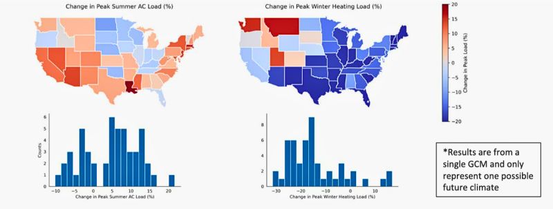
A 2023 NREL presentation shows how Sup3rCC models energy demand impacts. Image used courtesy of NREL (Slide 9)
This is where Sup3rCC would be a valuable resource for grids facing unpredictable weather changes. For instance, in measuring solar and temperature compound events, one map could show the hottest days in the West during unseasonably low wind and solar events from 2015-2024 and 2050-2059. In 2058, the future event might be 34.5°F hotter in the West but up to 37.9°F hotter with a localized temperature in Los Angeles.
Comparing this data helps planners understand how regional events can evolve and add system stress under various climate change scenarios.
Sup3rCC is free and publicly available on GitHub and the Open Energy Data Initiative website. The initial dataset spans 2015 to 2059 with two GCMs. Consider these file sizes for scale: The smallest 18 GB file only covers one variable, while a full year of data amounts to 216 GB.