Facebook
 Google
 GitHub
 Linkedin
AI-Powered Digital Twins for a Resilient Energy Infrastructure and Wildfire Prevention
Siemens Energy and NVIDIA are building geospatially accurate 3D AI models of our electrical grid to optimize utility operations, maintenance, and response plans for emergencies and natural disasters.
This article is co-authored by Marc Spieler, Senior Managing Director at NVIDIA.
We all watched the horrific fires tear apart Los Angeles in January. The utility industry has seen this before – fires that disrupt utility service and those caused by utility equipment, like in Northern California in 2018. It reminds us in a haunting way that measures to prevent and mitigate wildfire spread are of critical importance.
Digitalization and artificial intelligence (AI) are omnipresent in our modern society, radically transforming every aspect of our world. There is still untapped potential to leverage the power of AI. If we invest in these tools as part of a comprehensive natural disaster preparation plan, we can avert danger before it occurs.
Data Foundation for Informed Decision Making
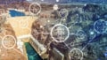
A Digital Twin (DT) is a dynamic replica of a physical object or system, enriched with data to accurately mirror its real-world counterpart. DTs have established themselves as a seminal solution in our industry, especially when powered by AI.
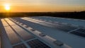
Digital twins of the energy infrastructure can improve performance, reliability, and safety.
The DT can only be as accurate as the data foundation upon which it is built. Consequently, instead of relying on a single source, it should incorporate many different types of data. Contextualization—aligning various sources of information to allow for holistic reasoning—is the optimal way to build a DT. By generating field-level quality insights through AI, we can transform traditional field operations into data-driven processes for informed decision making. Especially when time is of the essence.
Wildfire Risk Mitigation
While not all wildfires can be prevented, both proactive risk assessment and early detection are crucial for mitigating wildfire impact. Real-time monitoring and damage analysis can enable the right decisions and actions.
Specialized satellites can spot wildfires as small as a few meters from orbit with minimal latency. Weather satellite constellations provide valuable data inputs like humidity and soil moisture for an informed wildfire progression simulation and risk assessment, allowing for planning ahead and taking measures when there is still plenty of time.
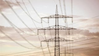
As we know, wildfires not only threaten energy infrastructure but are also sometimes caused by it. In recent years, grid-induced wildfires have taken their toll on far too many of our communities. Although infrequent in comparison to the total amount of annual wildfires, they tend to have a very high burned area per incident. Powerline-induced wildfires are often connected to vegetation clearance or equipment failure. They can and should be mitigated, if not outright prevented.
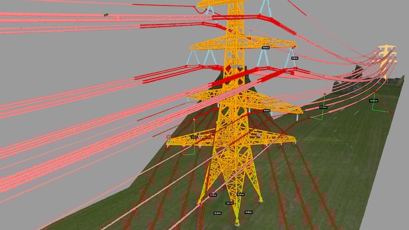
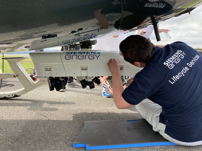
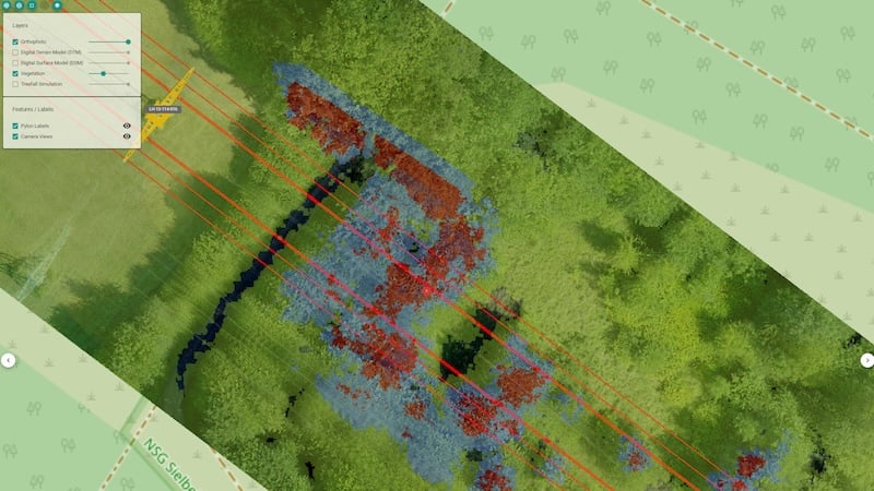
This is where rigorous asset inspection and monitoring enabled by data acquisition from aerial and satellite observation come into play. Imagery acquired by helicopters and drones provides close-ups and complete documentation, giving utilities a clearer picture of the health of power lines. A wide range of cameras, operating in the visual, infrared, or ultraviolet spectru,m supplemented by active sensors like 3D laser scanners, feed information into a smart analytics platform.
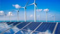
Aerial imagery can provide updated data to feed models and improve decision making.
A digital twin, powered by AI and fed by this rich data collection, allows for in-depth analysis, better decision making, and predictive maintenance.
Optical satellite imagery, while generally of lower resolution, can be helpful when monitoring vegetation growth and setting clearance schedules. This analysis can be done at more frequent intervals than data gathered by manual flyovers. These approaches are not mutually exclusive: Airborne laser scanning (LIDAR), satellite data, and even data from sensors placed on powerlines and poles should be combined.
Wildfire Response
During a wildfire, simulation frameworks can layer in dynamic data such as wind speed and direction available from weather service data providers in high geospatial and temporal resolution. While more sophisticated models apply as a general rule of thumb, a wildfire spreads at about 10% of the wind speed. Other factors in the wildfire forecast include the terrain topography and so-called fuel (vegetation and ground layer composition and condition).
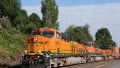
Specialized models and increased sensing can detect, and hopefully prevent, wildfires caused by overhead power lines.
Such simulations provide an outlook that teams in the field can rely on. They offer full situational awareness in real time, helping to keep utility workers and all emergency responders on the same page.
Sensors installed on the infrastructure can provide additional situational awareness, even if they are normally intended for different purposes. Dynamic Line Rating sensors sometimes come with cameras installed, and these images can be used for the detection of smoke in the environment and to remotely assess if the wildfire has actually hit a specific section of the grid.
Besides, these sensors can record the maximum temperature the conductor was exposed to during the event of the wildfire. Conductors can withstand an increased thermal stress for a limited time. Knowing if the conductor temperature reached or exceeded critical values during the wildfire event can provide valuable information for both response and recovery.
Wildfire Recovery
With Dynamic Line Rating (DLR), we can monitor the capacity of transmission lines in real-time, including temperature, wind speed, and line sag. When the unfortunate time comes for post-disaster grid restoration, grid operators can determine the maximum load on undamaged lines and effectively redistribute power. This prevents overloads and allows undamaged lines to carry more load while damaged areas are repaired.
Satellite and aerial imagery can provide accurate information on the area burned shortly after the incident to help understand and prioritize the sections of the line that need deeper inspection.
Automatic change detection can provide support by pre-filtering the amount of data that needs to be visually observed, thus greatly speeding up diagnostic efforts.
Most of these approaches can also be applied to other natural disasters, such as hurricanes or floods. While the individual data and models may differ, the same general principles apply.
AI Collaboration
Siemens Energy is collaborating with NVIDIA to explore solutions for some of the most urgent challenges in the energy system, such as wildfires, using new AI technologies. We plan to build a new AI Lab that will use NVIDIA AI expertise as well as accelerated computing to process geospatial data that will be used to train and fine-tune domain-specific AI models. These combined technologies can analyze this trove of data, in real time, to optimize utility operation and diagnose and prioritize grid maintenance. This analysis can also become a roadmap for action in emergencies and natural disasters.
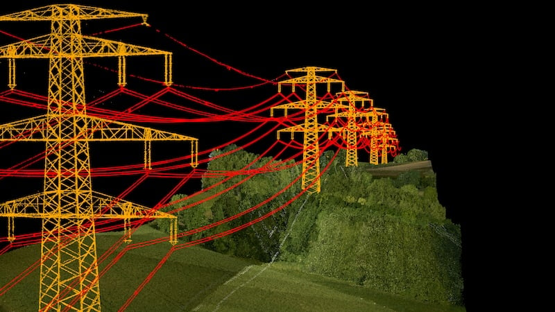
Power line modeling coupled with 3D terrain and landscape mapping can mitigate wildfire risk.
In a world where electricity, connectivity, and digitalization form the backbone of our modern society, “always on” is the new norm. The utility companies and internet providers that stand behind these services promise 24/7 reliability and turn to technology providers for solutions. AI is driving demand for more electricity, but the security of supply and grid resilience must tap into the power of AI to keep our communities safe.
All images used courtesy of Siemens Energy.